Innlent
Erlent
Veður
Forsetakosningar
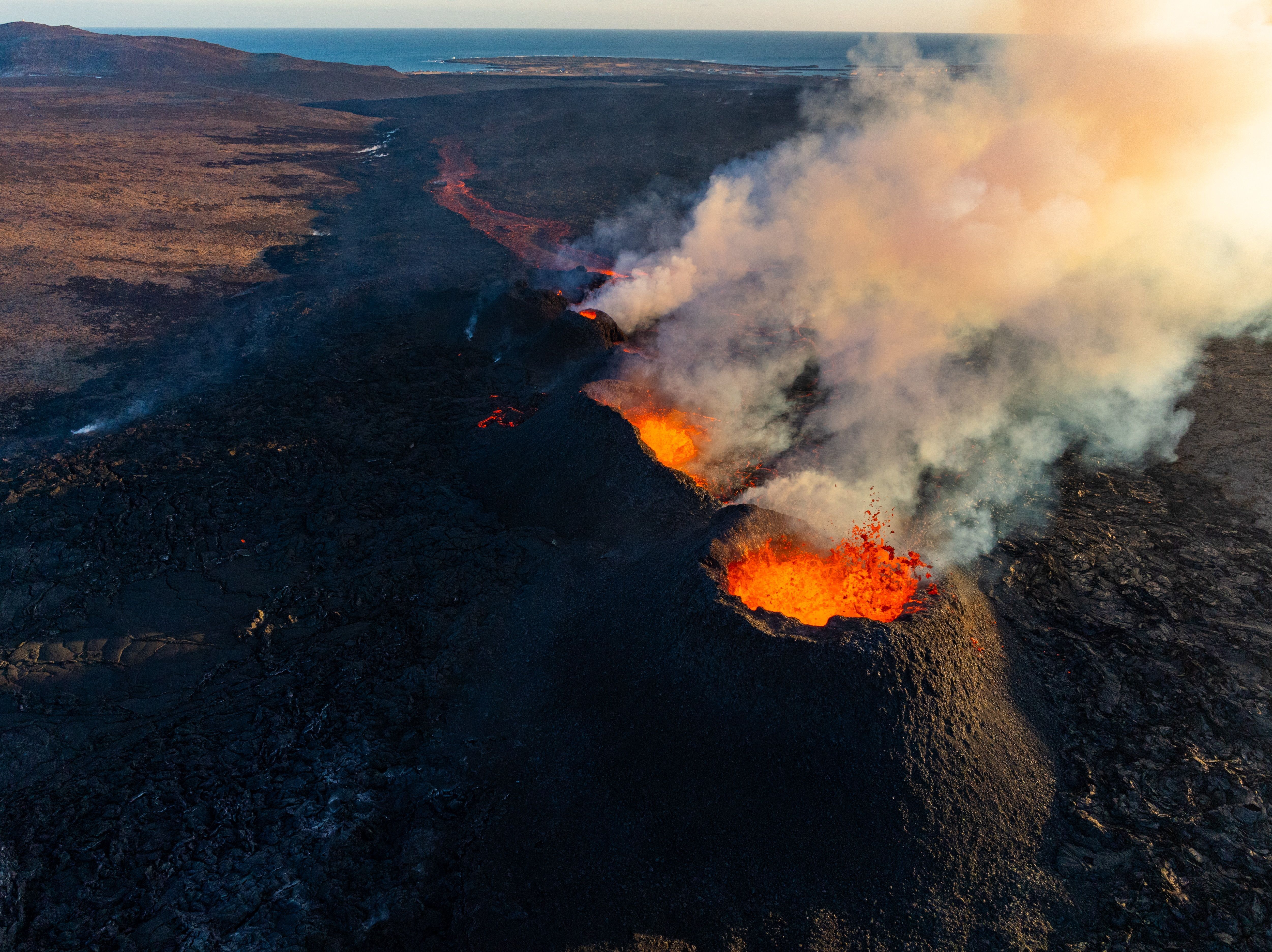
Reykjaneseldar
Ríkisstjórn
Alþingi
Dómsmál
Ferðaþjónusta
Kjaraviðræður
Andlát
Pallborðið
Kompás
Innlent
Erlent
Atvinnulíf
Neytendur
Kauphöllin
Seðlabankinn
Vistaskipti
Veitingastaðir
Samstarf
Fréttir af flugi
Fasteignamarkaður
Ferðaþjónusta
Staðan í deildum
Fótbolti
Körfubolti
Handbolti
Íslenski boltinn
Enski boltinn
Meistaradeildin
Subway-deild karla
Subway-deild kvenna
Olís-deild karla
Olís-deild kvenna